 ar
ar bg
bg hr
hr cs
cs da
da nl
nl fi
fi fr
fr de
de el
el hi
hi it
it ko
ko no
no pl
pl pt
pt ro
ro ru
ru es
es sv
sv tl
tl iw
iw id
id lv
lv lt
lt sr
sr sk
sk sl
sl uk
uk vi
vi et
et hu
hu th
th tr
tr fa
fa ms
ms hy
hy ka
ka ur
ur bn
bn mn
mn ta
ta kk
kk uz
uz ku
ku
settlement sensors
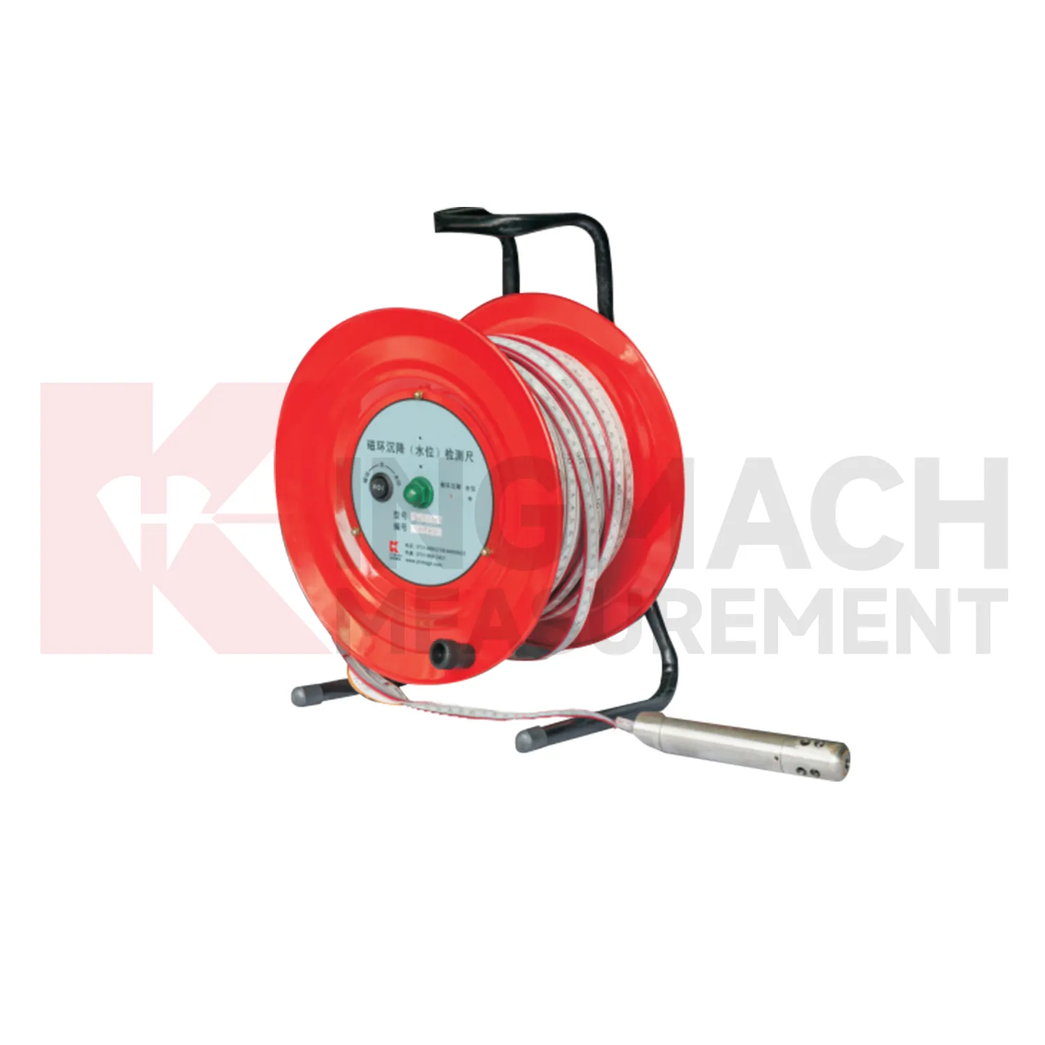
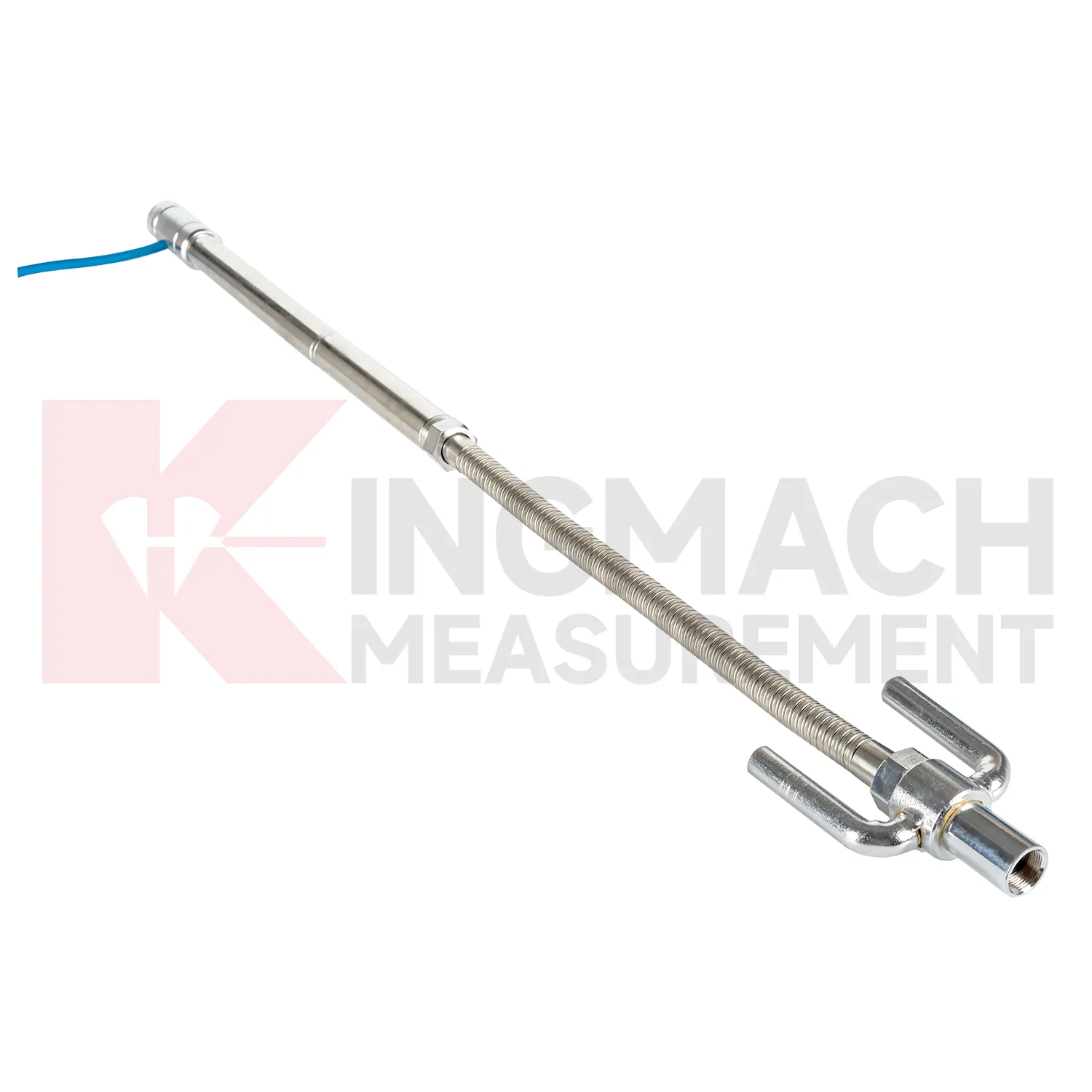
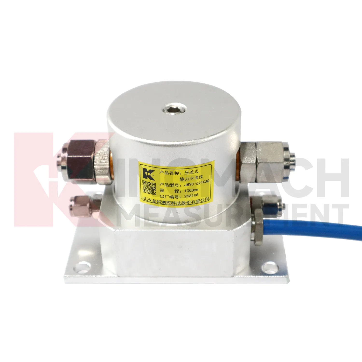
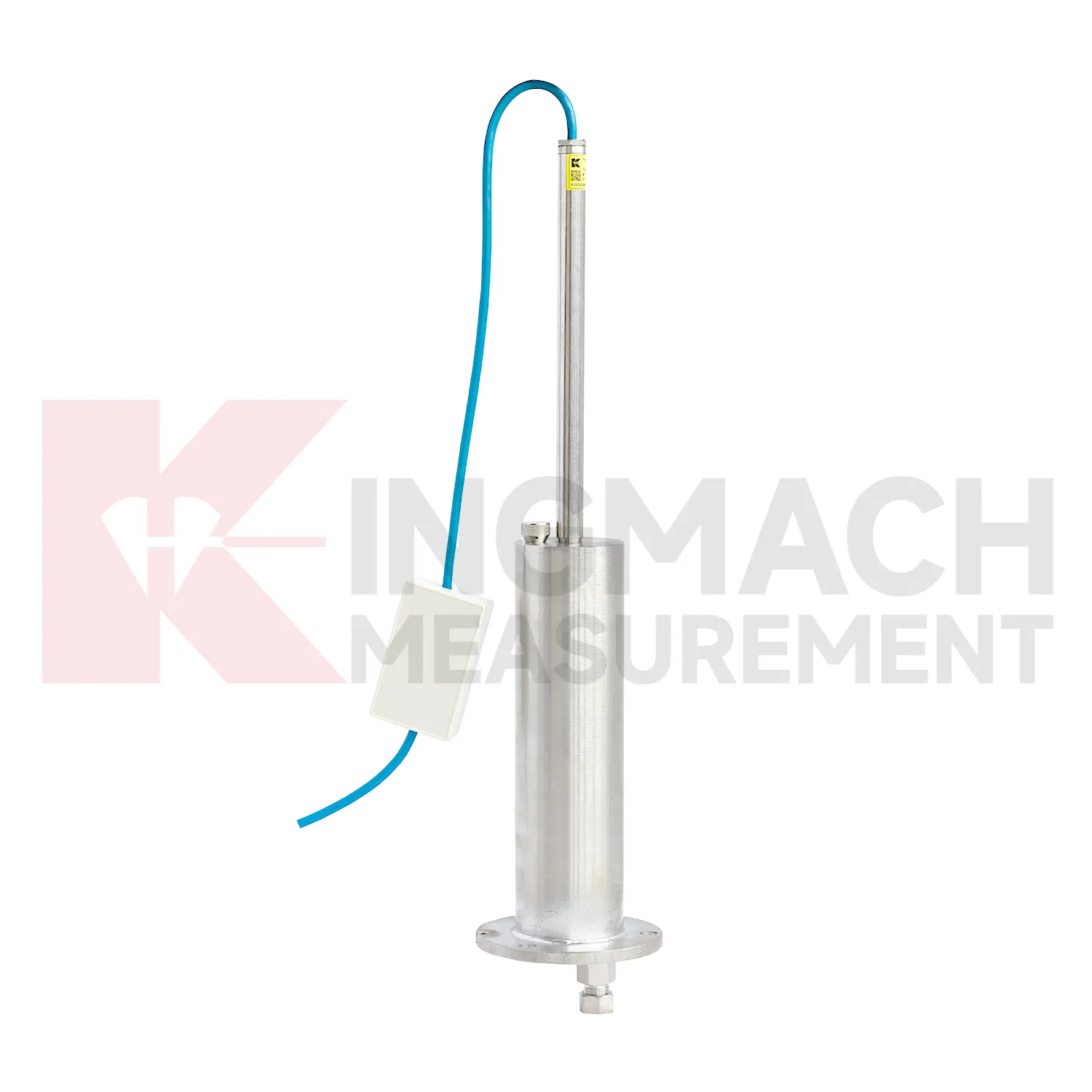
Selecting Kingmach settlement sensors begins with the scale and shape of expected movement. A single embedded point, a hydrostatic comparison line, a wide-range profile, and a magnetic ring borehole answer different questions. JMDL-47XXAT covers 100 mm to 400 mm embedded settlement. JMDL-62XXADT and JMQJ-62XXADT provide 0.01 mm hydrostatic resolution for smaller vertical changes. JMYC-62XXAD covers 500 mm to 4000 mm with 0.1 mm resolution and 0.2%FS accuracy for larger movement. JMCJ-1003/1005 provides plus or minus 1 mm depth reading for magnetic ring settlement and water level checks. Selection should consider whether the structure will remain accessible, whether groundwater is part of the risk, whether automatic collection is required, and whether the reference point can remain stable for the full observation period. A short-range high-resolution instrument is not automatically better if the site may move beyond its travel. A large-range system is not always best if the project needs very small early warnings.
Application of settlement sensors
In road and railway subgrade work, settlement sensors help track how fill, soft ground, and pile-net foundations behave after each construction stage. The risk is not only final settlement; engineers also need to know whether movement slows after compaction, continues after traffic loading, or restarts after rainfall. Kingmach JMDL-47XXAT can measure in-situ subgrade settlement and embankment heave with 100 mm, 200 mm, 300 mm, and 400 mm ranges. For longer pavement profiles, JMYC-62XXAD wide-range differential pressure hydrostatic sensors can compare several points against a reference, with 500 mm to 4000 mm ranges and 0.1 mm resolution. A practical subgrade monitoring plan records fill height, compaction stage, traffic opening date, groundwater condition, and nearby deformation readings. This helps maintenance teams decide whether the roadbed is consolidating normally or needs inspection before track or pavement defects appear. The monitoring team should keep point location, reference condition, construction timing, groundwater or water level notes, and nearby sensor behavior in one review file so the settlement curve can be interpreted without guesswork during later maintenance. The monitoring team should keep point location, reference condition, construction timing, groundwater or water level notes, and nearby sensor behavior in one review file so the settlement curve can be interpreted without guesswork during later maintenance.
The future of settlement sensors
The future of settlement sensors will also depend on better installation kits. Many settlement errors begin with field details: a tube is kinked, a plate is disturbed during compaction, a ring depth is recorded poorly, a cable exits at the wrong place, or a reference point is not protected. Future products can reduce these problems with clearer connectors, pre-labeled cables, stronger side-exit protection, better probe markings, and commissioning checklists. Kingmach JMDL-47XXAT already uses side-exit cable routing to avoid pavement compaction interference, and hydrostatic systems rely on clean tube installation. Better installation accessories will make the first baseline more trustworthy. In settlement monitoring, a clean start is often more useful than a later attempt to correct a poor record. The practical goal is to keep settlement data understandable after the original installation crew has left, so owners can compare old and new readings without reconstructing the field history from memory. The same record should remain readable for designers, contractors, owners, and maintenance teams, because settlement monitoring often continues long after the first construction report is finished.
Care & Maintenance of settlement sensors
Manual-reading settlement sensors should follow a repeatable procedure every visit. Use the same reference mark, reading direction, tape handling method, waiting time, and data sheet format. This is especially important for magnetic ring settlement gauges and borehole water level readings, where inconsistent field practice can create false changes. Record operator, weather, groundwater condition, borehole obstruction, battery condition, and any unusual sound or visual indication from the alert system. Do not round readings differently from one visit to the next. If manual data is later entered into software, keep the original field notes available for checking. Manual monitoring can be reliable over many years when the process is simple, dated, and boringly consistent. The goal is repeatability, not speed.
Kingmach settlement sensors
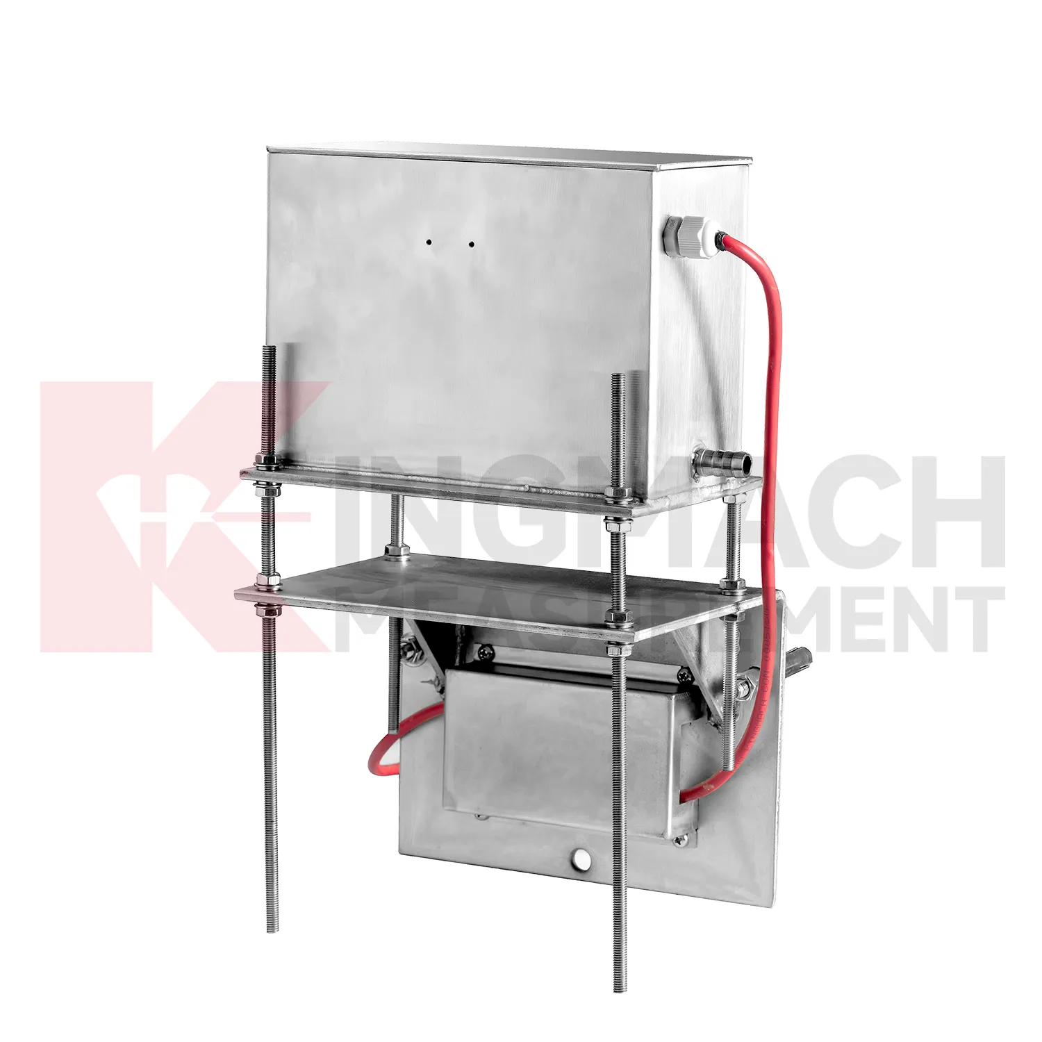
For dams and water-related structures, settlement sensors must be read together with hydraulic conditions. Dam settlement, bridge deflection near water, dyke compression, and foundation deformation may respond to reservoir level, seepage, rainfall, temperature, and seasonal operation. Kingmach JMQJ-62XXADT and JMDL-62XXADT hydrostatic sensors can support multi-point vertical deformation monitoring, while JMCJ-1003/1005 can add groundwater level and layered settlement information. The field record should identify reference point, tube layout, cabinet position, water level, and inspection date. A reading after heavy rain has a different meaning from the same reading during a dry operating period. Settlement data becomes stronger when it is tied to the water story around the structure. The practical aim is a traceable vertical movement history that can support construction control, maintenance planning, and risk review without rewriting the site story. The practical aim is a traceable vertical movement history that can support construction control, maintenance planning, and risk review without rewriting the site story.
FAQ
Q: What are settlement sensors used for?
A: They measure vertical deformation such as foundation settlement, subgrade settlement, embankment heave, tunnel bottom uplift, dam settlement, bridge deflection, and building settlement.
Q: Which Kingmach models are related to this group?
A: Common models include JMDL-47XXAT, JMDL-62XXAT/ADT, JMQJ-62XXADT, JMYC-62XXAD, and JMCJ-1003/1005.
Q: What is the difference between single-point and hydrostatic monitoring?
A: Single-point gauges measure settlement at a specific embedded point, while hydrostatic systems compare several points against a reference level through connected liquid paths.
Q: Can the readings be collected remotely?
A: Yes. Several Kingmach hydrostatic and settlement instruments support RS485 output or automatic acquisition systems for remote collection.
Q: Why is the reference point important?
A: Settlement is often calculated relative to a reference. If the reference changes or is poorly documented, the whole settlement curve can become misleading.
Reviews
Daniel Brown
Excellent environmental monitoring sensors. The data is consistent, and the system integrates smoothly with our existing setup.
Robert Taylor
The weir flow meter is well-built and delivers accurate measurements. Great value for water management applications.
Latest Inquiries
To protect the privacy of our buyers, only public service email domains like Gmail, Yahoo, and MSN will be displayed. Additionally, only a limited portion of the inquiry content will be shown.
Amelia***@gmail.comSingapore
Hello, I am looking for visualization software for monitoring system data analysis. Please let me kn...
Olivia***@gmail.comUnited States
Hello, we are currently sourcing high-precision strain gauges and load cells for a bridge monitoring...
Related product categories
- Magnetic Ring Settlement Water Level Gauge
- Optical Deflection Monitor
- Tilt Sensor
- Deflectometer
- Micro Range Hydrostatic Level Sensor
- Single-point Settlement Meter
- Optical Deflection Monitor
- Inclinometer-based Hydrostatic Leveling System
- Settlement Monitoring Rod
- Hydrostatic Leveling System
- Photoelectric Deflectometer
- gnss settlement sensors